Contributor
RickStudent, Philosopher, Writer, Developer
Highslide JS
James Wilson Marshall House — 62 Bridge Street, Hopewell Township, NJ
The Marshall House is on the National and the New Jersey Registers of Historic Places. It was the boyhood home of James Wilson Marshall, discoverer of gold in California, and is now the headquarters of the Lambertville Historical Society. James' father, Philip, built the house in 1816. Philip Marshall, a coach and wagon maker, was a member of one of the oldest families in New Jersey and a relative of John Hart, a signer of the Declaration of Independence. The family lived here until Philip's death in 1834, when the property was sold. Family descendants continue to live in Lambertville and the surrounding area. The house was constructed using bricks made of clay dug near the outskirts of town and is notable for its Federal architecture, with its decorative, Adam-style frieze, box cornice, and typical two-story structural style and size.
Photo Credit: https://web.archive.org/web/20011104201645/http://www.lambertvillehistoricalsociety.org/marshall.php3
James Wilson Marshall House 62 Bridge Street, Hopewell Township, NJ
The Marshall House is on the National and the New Jersey Registers of Historic Places. It was the boyhood home of James Wilson Marshall, discoverer of gold in California, and is now the headquarters of the Lambertville Historical Society. James' father, Philip, built the house in 1816. Philip Marshall, a coach and wagon maker, was a member of one of the oldest families in New Jersey and a relative of John Hart, a signer of the Declaration of Independence. The family lived here until Philip's death in 1834, when the property was sold. Family descendants continue to live in Lambertville and the surrounding area. The house was constructed using bricks made of clay dug near the outskirts of town and is notable for its Federal architecture, with its decorative, Adam-style frieze, box cornice, and typical two-story structural style and size.
Highslide JS
The spot where Marshall first discovered the gold that started the California Gold Rush
Photo Credit: By Bobak Ha'Eri - Own work, CC BY 3.0, https://commons.wikimedia.org/w/index.php?curid=7438217
Highslide JS
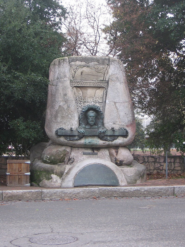
James W. Marshall
Photo Credit: Public Domain, https://commons.wikimedia.org/w/index.php?curid=31247940
Highslide JS
Wreck of the Titanic — View of the bow of the RMS Titanic photographed in June 2004 by the ROV Hercules during an expedition returning to the shipwreck of the Titanic
Photo Credit: Public Domain, https://commons.wikimedia.org/w/index.php?curid=18643198
Wreck of the Titanic View of the bow of the RMS Titanic photographed in June 2004 by the ROV Hercules during an expedition returning to the shipwreck of the Titanic
Highslide JS
"Untergang der Titanic" — as conceived by Willy Stöwer, 1912
Photo Credit: By Willy Stöwer - Public Domain, https://commons.wikimedia.org/w/index.php?curid=97646
"Untergang der Titanic" as conceived by Willy Stöwer, 1912
Highslide JS
The route of Titanic's maiden voyage — Titanic was planned to arrive at New York Pier 59 on the morning of 17 April. After leaving Queenstown, Titanic followed the Irish coast as far as Fastnet Rock, a distance of some 55 nautical miles. From there she travelled 1,620 nautical miles along a Great Circle route across the North Atlantic to reach a spot in the ocean known as "the corner" south-east of Newfoundland, where westbound steamers carried out a change of course. Titanic sailed only a few hours past the corner on a rhumb line leg of 1,023 nautical miles to Nantucket Shoals Light when she made her fatal contact with an iceberg. The final leg of the journey would have been 193 nautical miles to Ambrose Light and finally to New York Harbor.
Photo Credit: By Prioryman - Own work, CC BY-SA 4.0, https://commons.wikimedia.org/w/index.php?curid=18584123
The route of Titanic's maiden voyage Titanic was planned to arrive at New York Pier 59 on the morning of 17 April. After leaving Queenstown, Titanic followed the Irish coast as far as Fastnet Rock, a distance of some 55 nautical miles. From there she travelled 1,620 nautical miles along a Great Circle route across the North Atlantic to reach a spot in the ocean known as "the corner" south-east of Newfoundland, where westbound steamers carried out a change of course. Titanic sailed only a few hours past the corner on a rhumb line leg of 1,023 nautical miles to Nantucket Shoals Light when she made her fatal contact with an iceberg. The final leg of the journey would have been 193 nautical miles to Ambrose Light and finally to New York Harbor.
Highslide JS
RMS Titanic departing Southampton — April 10, 1912
Photo Credit: By Francis Godolphin Osbourne Stuart - Public Domain, https://commons.wikimedia.org/w/index.php?curid=2990792
Highslide JS
RMS Titanic — 4/1912, at Southampton docks, prior to departure
Photo Credit: Public Domain, https://commons.wikimedia.org/w/index.php?curid=19027661
RMS Titanic 4/1912, at Southampton docks, prior to departure
Highslide JS
Betsy Ross — Posthumous depiction 1893
Photo Credit: Weisgerber, Charles H - Public Domain, https://commons.wikimedia.org/w/index.php?curid=94786535
Betsy Ross Posthumous depiction 1893
Highslide JS
Gemini/Titan-II launch vehicle #1 liftoff — Cape Kennedy, FL
Photo Credit: NASA - Public Domain, https://commons.wikimedia.org/w/index.php?curid=409355
Highslide JS
Gemini 2 spacecraft — on display at the Air Force Space and Missile Museum, Cape Canaveral Air Force Station, FL
Photo Credit: Public Domain, https://commons.wikimedia.org/w/index.php?curid=12793758
Gemini 2 spacecraft on display at the Air Force Space and Missile Museum, Cape Canaveral Air Force Station, FL